- Award score
- 4.5Rating
- 5,000,000+installs
- Free
App information
Screenshots
 Analysis byAppsAward
Our review of onX Hunt: Offline Hunting Maps
I judge a hunting map by more than how much information it contains. It also has to be readable when I’m planning at home, useful when I’m outside, and manageable when attention is already divided between terrain, equipment, and other people. onX Hunt is a sports app from onXmaps built around that practical job: bringing map layers, property boundaries, and GPS navigation together for hunt planning. Its focus is specific, which is a strength for hunters, though it also means it is not a general-purpose outdoor map for every kind of trip.
Reading the map and finding your way
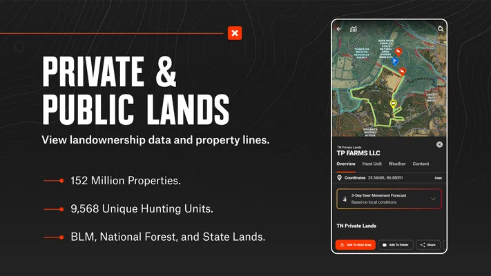
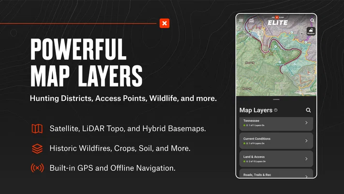
The main appeal is being able to consider terrain and land ownership in the same planning process. A topo map can help me think about slopes, ridges, and likely routes; property lines add a separate, important question about where those routes lead. Having both kinds of information available in one hunting-oriented app is more useful than switching repeatedly between a basic map and another source for boundaries.
That combination is especially helpful before a trip. I can inspect an area, mark places worth revisiting, and consider how a route relates to the surrounding land rather than choosing a promising-looking point without checking what lies around it. For someone who hunts unfamiliar ground, that context can make planning feel less like guesswork. Still, a map is a planning aid, not permission to enter land: I would treat boundary information as something to check carefully and confirm through appropriate local sources when access matters.
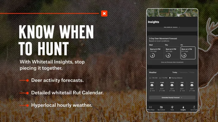
Map layers also give the app a more flexible role than a single fixed map view. Different layers can answer different questions, so I can focus on terrain while sketching a route, then bring property information into the decision before settling on a plan. A useful habit is to review the same route from both perspectives instead of assuming that a visually direct line is a practical or lawful one. That small planning step is one of the more meaningful advantages of having these details together.
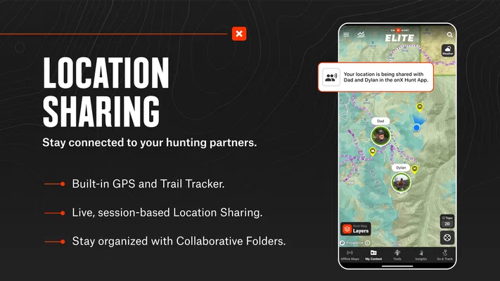
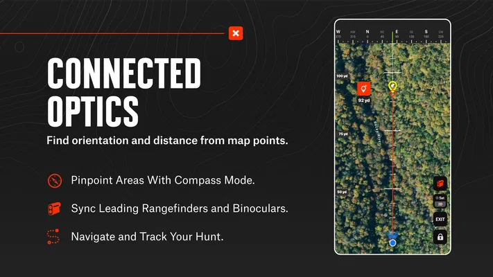
Navigation is another part of the appeal. GPS positioning can help me relate my location to the map and planned route, which is valuable when landmarks look different on the ground than they did on a screen. I would use it to maintain orientation and check progress, not as a substitute for paying attention to the actual terrain. In dense cover, poor visibility, or unfamiliar surroundings, a digital marker is only as useful as my ability to interpret it alongside what I can see.
The app is free to install, and it has a 4.5 average from around 65,000 ratings. That gives a prospective user a sense of how widely it is used, but ratings cannot tell me whether its map presentation will work for my eyes, hands, or particular hunting area. I would spend time exploring the interface before relying on it for a demanding outing. onX Hunt is listed for users of all ages, though the outdoor decisions it supports still call for sound judgment and appropriate supervision where relevant.
Practical planning, not just a screen full of layers
A useful workflow is to separate scouting from route commitment. I would first look for terrain features that make an area worth considering, then inspect boundary lines, and only then choose a route or waypoint. This order reduces the chance of becoming attached to a location before noticing that the approach crosses land I should not enter. It also makes the map less visually overwhelming: each pass has a purpose rather than asking me to interpret everything at once.
For a realistic everyday example, imagine checking a new area after work for a weekend hunt. I could use the topo view to compare a few possible approaches, then examine property lines around each option and save the most promising locations for a later review. At home, I have time to zoom, compare, and reconsider. On the day itself, the map can help me keep track of where I am relative to those plans. That division of labor matters: the phone is easier to use as a reference in the field when the important decisions have already been thought through.
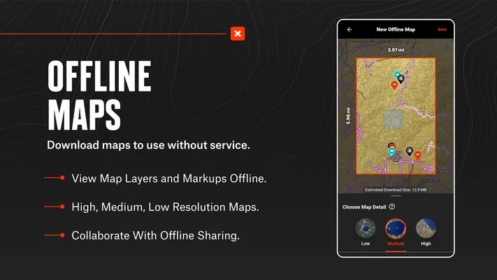
Offline maps are part of the app’s identity, and they are most valuable when a trip takes me beyond dependable connectivity. The key practical point is to prepare before leaving coverage: I would check that the areas I need are available for offline use and confirm the saved map is ready while I still have a connection. Offline access can reduce dependence on a live signal, but it cannot fix a plan that was never downloaded or an area that was not included. This is a simple step, yet it is easy to overlook when planning happens at the last minute.
Different abilities and field conditions
Map reading is a visual task, and that creates a real trade-off. Topography and property boundaries are useful precisely because they add detail, but detail can also make a screen harder to scan quickly. I would keep the view focused on the question I am answering, zoom in when a boundary needs closer inspection, and avoid trying to interpret a cluttered map while moving. For anyone who finds small labels or layered lines difficult to distinguish, testing the display in comfortable conditions before a hunt is more sensible than discovering the problem outdoors.
GPS navigation can reduce the need to remember every turn or continually compare a paper map with the landscape. At the same time, it asks the user to look at and operate a phone. That is not always convenient for someone with limited hand dexterity, gloves, tremors, or difficulty making precise screen selections. I would plan around those realities: save the relevant locations in advance, use the map for brief checks rather than constant interaction, and carry another dependable way to orient myself if operating the device becomes awkward.
Sensory context matters too. A screen can be hard to consult in bright conditions, and a hunt may involve noise, cold, fatigue, or divided attention. I would not assume that an app can make every situation accessible simply because it puts information on a phone. The sensible approach is to try the interface in conditions resembling the outing, decide whether I can read and control it comfortably, and avoid relying on rapid visual checks when doing so would distract me from safe movement.
There is also a difference between making a map available offline and making the whole experience effortless without connectivity. Offline access addresses one major field constraint, but it does not remove the need to prepare, charge the device, or understand the route. I would treat the phone as one part of a navigation setup rather than the only part. For hunters who are comfortable using a touchscreen and planning ahead, this can be a practical compromise; for anyone who needs a large, simple, always-visible reference, a paper map may be easier to handle.
Where it fits—and where it does not
Compared with a general mapping app, onX Hunt is more directly organized around hunting questions: terrain, property boundaries, and GPS-based orientation. A general map may be simpler for ordinary driving or a casual walk, and a paper map can be easier to read at a glance without navigating menus or managing a battery. Those alternatives are not automatically better; they serve different needs. If land ownership and hunting-oriented planning are central, this app has a clearer purpose than a generic map. If they are not, its specialized focus may be unnecessary.
Its strongest audience is someone who regularly plans hunts, explores unfamiliar areas, or wants terrain and boundary context in the same workflow. It can also suit a person who likes preparing at home and then using a saved map as a field reference. I would be less inclined to recommend it to someone who rarely hunts, wants a basic trail map, dislikes smartphone navigation, or needs an interface they can operate easily without looking closely at a screen. In those cases, a simpler map or a familiar paper alternative may be a better fit.
The app has been available since November 8, 2013, and has more than five million installs. That history and reach suggest it is an established option, but they do not remove the need to decide whether its layout suits you. The app itself is free, with optional in-app purchases listed from $9.99 to $99.99 per item. I would look closely at what I personally need before spending: the value depends on whether the paid options support the places and planning habits that matter to me, not just on the number of tools available.
One limitation I would keep in mind is that map information can invite overconfidence. A crisp line on a screen may look definitive, yet responsible access decisions deserve care and local awareness. The app can help me notice a boundary and plan around it; it cannot make judgment unnecessary. Likewise, GPS is useful for orientation but should not encourage me to walk while staring at a display or assume that the suggested route is automatically safe on the ground.
A considered recommendation
onX Hunt is a worthwhile choice when hunting-specific map context is the main reason I am reaching for my phone. Its combination of topo information, property boundaries, GPS navigation, and offline planning makes it more purposeful than a generic map for preparing and checking a hunt. I especially value the workflow of assessing terrain first, checking access next, and saving a plan before heading out. That approach turns the app from a collection of map details into a more deliberate planning tool.
My recommendation comes with a clear condition: try it in the way you expect to use it. Check whether the map is comfortable to read, whether operating it feels manageable, and whether you can prepare the areas you need before losing service. If those steps work for you, the app can make planning more organized and field orientation less dependent on memory. If screen use is tiring or difficult, or if you only need a simple outdoor map, a less specialized option may be more comfortable.
Overall, I see onX Hunt as a focused aid rather than a substitute for preparation, local knowledge, or good judgment. Its strengths are most apparent when a hunter uses its layers together and plans ahead; its friction shows up when a detailed screen has to be read or controlled in challenging conditions. For the right person, that is a useful balance. For everyone else, the best choice may be the map they can interpret confidently when it matters.
Pros
- Offline maps keep key navigation available beyond cell coverage.
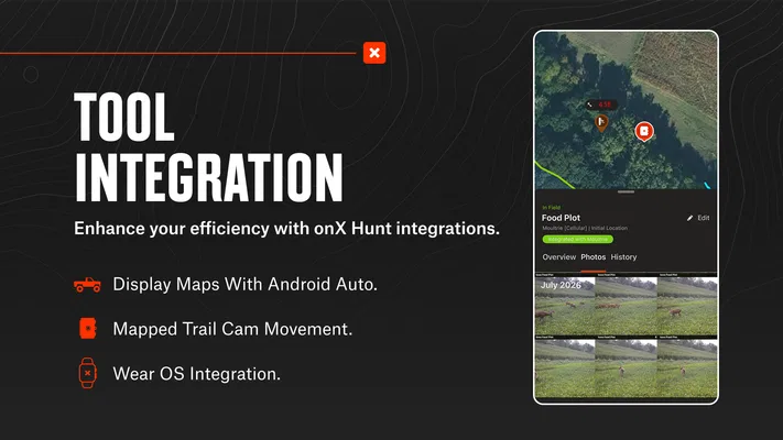
- Custom waypoints make it easy to mark stands and trail cameras.
- Property boundaries help identify land ownership before a hunt.
- Layer controls let hunters tailor the map to their needs.
- Map tools support planning routes and measuring distances.
Cons
- Many advanced mapping features require a paid subscription.
- Offline areas need to be downloaded before losing service.
- Detailed maps can use substantial storage on your device.
- Boundary data may not reflect the latest ownership changes.
- The range of map layers can feel overwhelming to new users.
Best Sports App 2026
Our verdict
Plan your hunt with topo maps, property lines, GPS navigation, and map layers
Frequently Asked Questions
What is onX Hunt: Offline Hunting Maps used for?
onX Hunt is a mapping and planning app designed to help hunters explore public and private land, review property boundaries, and prepare for trips. It provides hunting-focused map layers and tools such as saved locations, waypoints, and route planning. The information can support decision-making in the field, but users should still verify access rules, land ownership, and current local regulations before hunting.
Can I use onX Hunt without an internet connection?
Yes, the app offers offline maps, which can be useful in areas with weak or no cellular service. You need to download the map areas you expect to visit while you have a connection, then check that they are available on your device before heading out. Offline access does not guarantee that every feature or live information source will work without internet.
Does onX Hunt show public and private property boundaries?
The app includes map information intended to help users identify public lands and private property boundaries, along with landowner details where available. Coverage and data accuracy can vary by location, and ownership information may change over time. Treat map boundaries as a planning reference rather than a legal survey, and confirm access rights with authoritative sources before entering property or relying on a boundary.
Is onX Hunt free to use, or does it require a subscription?
onX Hunt may provide a limited free experience, while access to additional map layers, offline capabilities, or broader coverage can depend on the current membership options. Subscription features and prices may vary by plan, region, and platform, so review the details shown in the app store and within the app before purchasing. Check renewal terms and cancellation instructions if you choose a paid plan.
What should I know before relying on onX Hunt during a hunting trip?
Before your trip, download the needed maps, confirm they open offline, and save important waypoints or routes. Bring a charged phone and consider a backup power source, while remembering that GPS positioning and map data can have limitations. Check current hunting seasons, permits, access restrictions, and safety conditions through official sources; the app is a planning aid, not a replacement for legal guidance or sound field judgment.